Diamond Lake & the White Horse Farm
A small lake, a family landmark, and a useful place to read three layers of local transportation history.
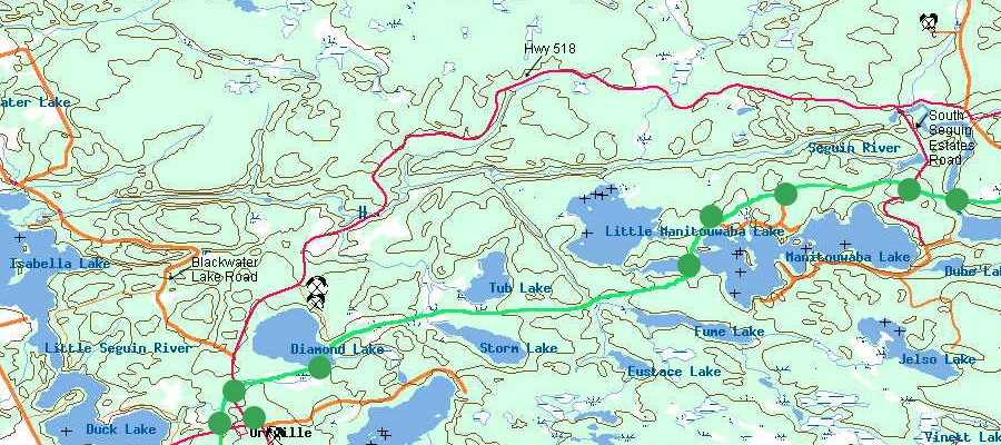
Diamond Lake is a small lake just north of Orrville and immediately beside the landscape explored by the original Seguin Trail site. It matters here for two reasons: the old trail maps identify it as an access/camping area, and the road nearby contains one of the author's strongest family landmarks — the place always called the White Horse Farm.
The lake
An Ontario Ministry of Natural Resources lake fact sheet identifies this Diamond Lake in Christie geographic township at approximately 45.393° N, 79.772° W. It gives a surface area of about 53.5 hectares, a maximum depth of about 4 metres, a mean depth of about 1.9 metres, and places the lake in the Little Seguin River drainage basin. Those numbers describe a relatively small, shallow lake — very different from the much larger cottage lakes elsewhere in the district.
Why this matters to the trail archive
The original clickable trail map marked a “Diamond Lake Camping Spot.” Even when an old link or page was never fully developed, the map itself preserves what the site author considered useful field information at the time. That makes the old map part guide, part historical record of how the corridor was explored.
The White Horse Farm
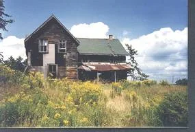
The photograph above is not Whitehall, as an early rebuild temporarily assumed. The site author remembers this property on Highway 518 near Diamond Lake as the White Horse Farm. An old white horse was almost always visible around the property and sometimes helped itself to flowers from the window-box planters. The family name was informal, but persistent enough that the farm became a navigational landmark in its own right.
That recollection is intentionally recorded here as local memory, not as a claim about the property's legal or historic name. A future land-record search may establish the farm family, lot/concession, and dates of occupation.
Highway 518 and the older transportation landscape
Highway 518 now provides the familiar east-west road through Orrville, Diamond Lake, Seguin Falls, Bear Lake and Sprucedale. The railway corridor is older than the numbered highway, and the nearby Nipissing Road is older still. In a remarkably small area, three transportation eras overlap: colonization road, railway, and modern highway. That is one reason this stretch deserves more than a simple trail map.
Sources & notes
- Original SeguinTrail.ca map and
whfarm.jpg, preserved locally with this site. - Ontario Ministry of Natural Resources, Lake Fact Sheet — Diamond Lake, Parry Sound District: location and physical lake characteristics.
- The White Horse Farm name and horse story are first-hand family recollections supplied by the site author.