Reading the 1899 plan
A sheet-by-sheet explanation of what the plan shows and what it can tell us about the town and harbour.
The October 1899 Charles E. Goad fire-insurance plan is more than a map. It is a snapshot of a planned company town, a steam-locomotive servicing terminal and a Great Lakes transfer port only a few years after Depot Harbour opened.
Sheet 1 — the town and locomotive plant
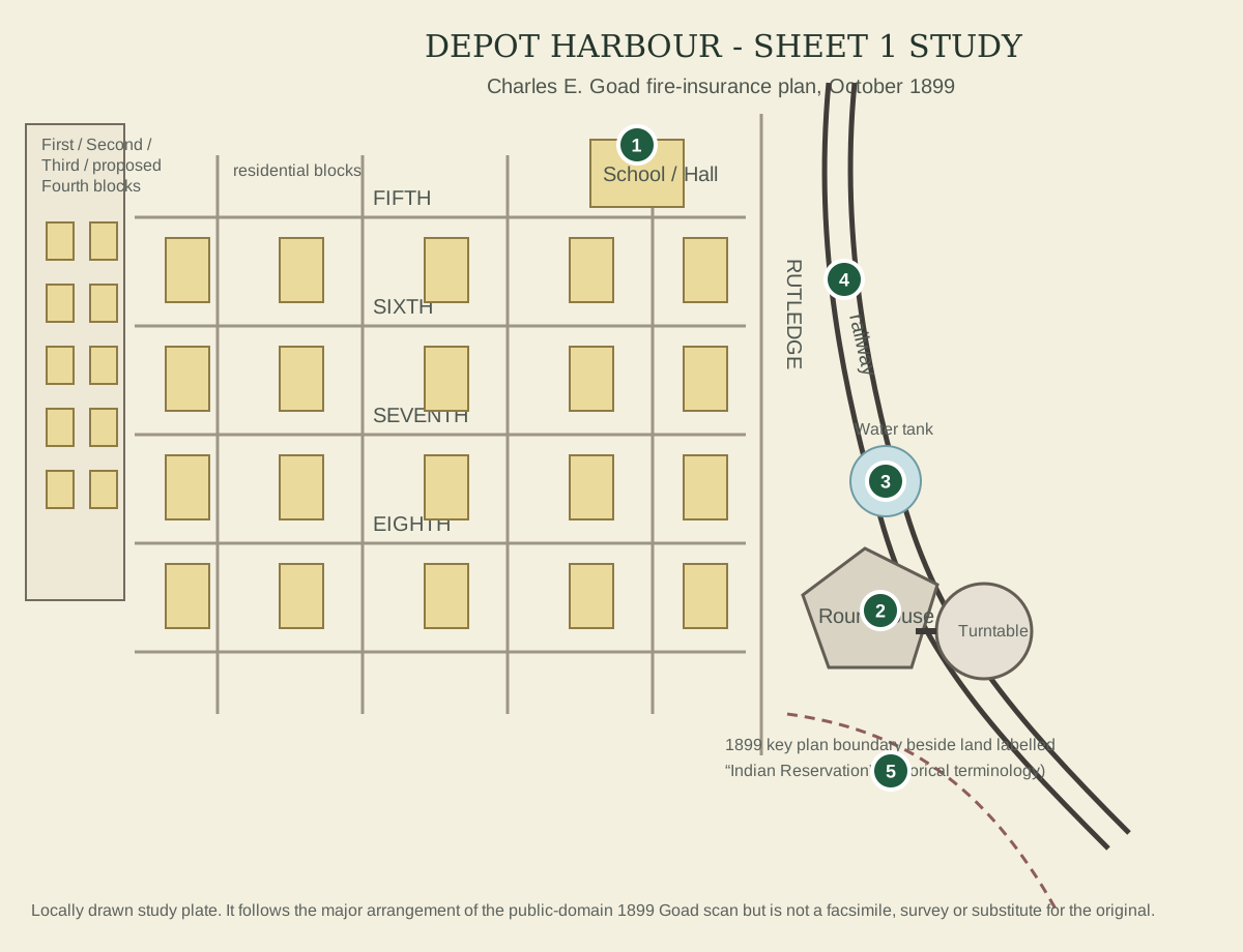
The plan identifies a school/hall within the residential grid, showing that community facilities were part of the company-town layout.
A terminal roundhouse and turntable appear beside the running tracks. This is direct evidence that locomotives were serviced and turned here rather than merely passing through.
Steam locomotives needed water infrastructure at the terminal. The plan places a tank beside the railway plant.
The rail lines form the eastern edge of the townsite before spreading toward the industrial waterfront.
The key plan uses the period term “Indian Reservation” for adjacent land. Today Depot Harbour is on Wasauksing First Nation; the historical term is retained only when describing what the 1899 document actually says.
Street names and layout
Goad’s first sheet shows a deliberately planned grid rather than an older village that had grown gradually. The visible street names include Fifth, Sixth, Seventh and Eighth, with earlier numbered streets continuing in the inset at the left. Rutledge runs along the railway side of the town, while Atlantic and Canada appear in the residential grid. The sheet title gives a population of about 300.
Sheet 2 — the industrial harbour
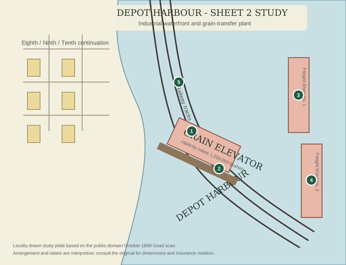
The plan annotates the elevator at 1,200,000 bushels capacity in 1899.
Tracks ran directly to the elevator/wharf complex, allowing grain and other freight to move between railway cars and Great Lakes vessels.
The plan labels two long freight sheds on the eastern waterfront, evidence that Depot Harbour handled substantial packaged and general freight in addition to grain.
Multiple tracks converge on the industrial area, showing the scale of switching required to feed the elevator and sheds.
What the plan lets us say with confidence
By October 1899 Depot Harbour already combined housing, a school/hall, locomotive facilities, a water system, a large grain elevator, multiple railway tracks and waterfront freight sheds. That is an unusually complete industrial system for a settlement only a few years old. The map also makes clear that the town and terminal were built on Parry Island within the geography of what is now Wasauksing First Nation.
What the plan does not tell us by itself
A fire-insurance plan was created to document buildings and fire risk, not to write social history. It does not tell us who lived in every house, the day-to-day relationship between the railway town and Anishinaabe residents of Parry Island, or how the town changed after later expansions. Those questions require census, land, company, newspaper and Indigenous historical sources alongside the map.
Original record
Charles E. Goad, Depot Harbor, Ontario, Parry Sound District, October 1899. Library and Archives Canada: copyright expired, consultation open. The Toronto Public Library scan is also available through Wikimedia Commons as a two-page public-domain PDF.