Historical originals kept with the site
Maps and records that should still be here even if another website disappears.
This shelf gathers historical documents and study material that are stored with SeguinTrail.ca. Keeping important records locally, where rights allow, protects the site from broken external links and lets maps and documents be explained alongside the history they support.
Two kinds of local material
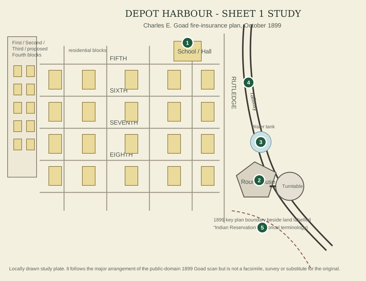
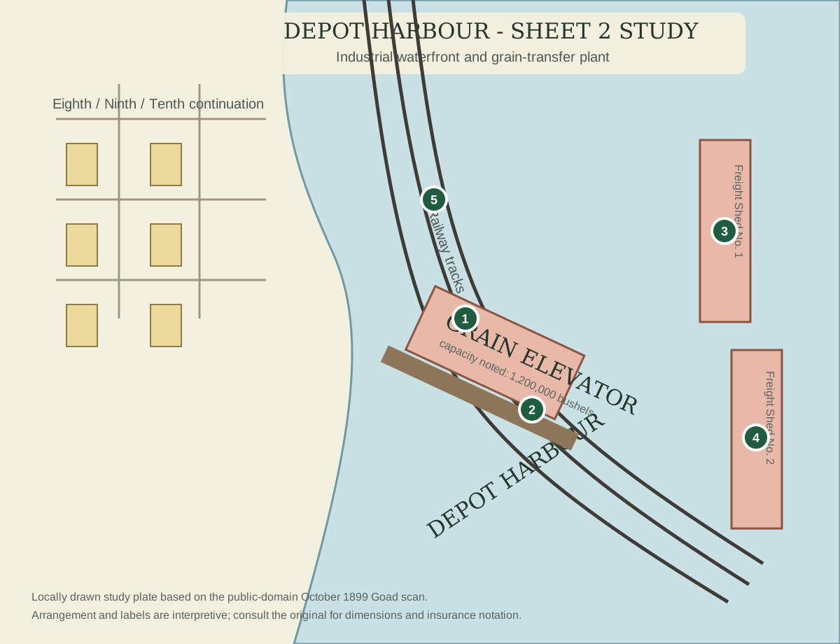
Original local file means the actual PDF/image is stored with the site. Local study plate means SeguinTrail.ca has created its own explanatory diagram or transcription from a verified historical source; it is never presented as the original scan.
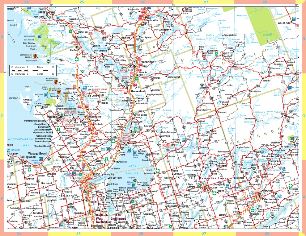
Central Ontario road & lake map
This PDF came from the original SeguinTrail.ca web root and is preserved unchanged in the rebuilt site. It is useful as a broad regional orientation map connecting Georgian Bay, Parry Sound, Huntsville and the inland lake district.
Parry Sound area map
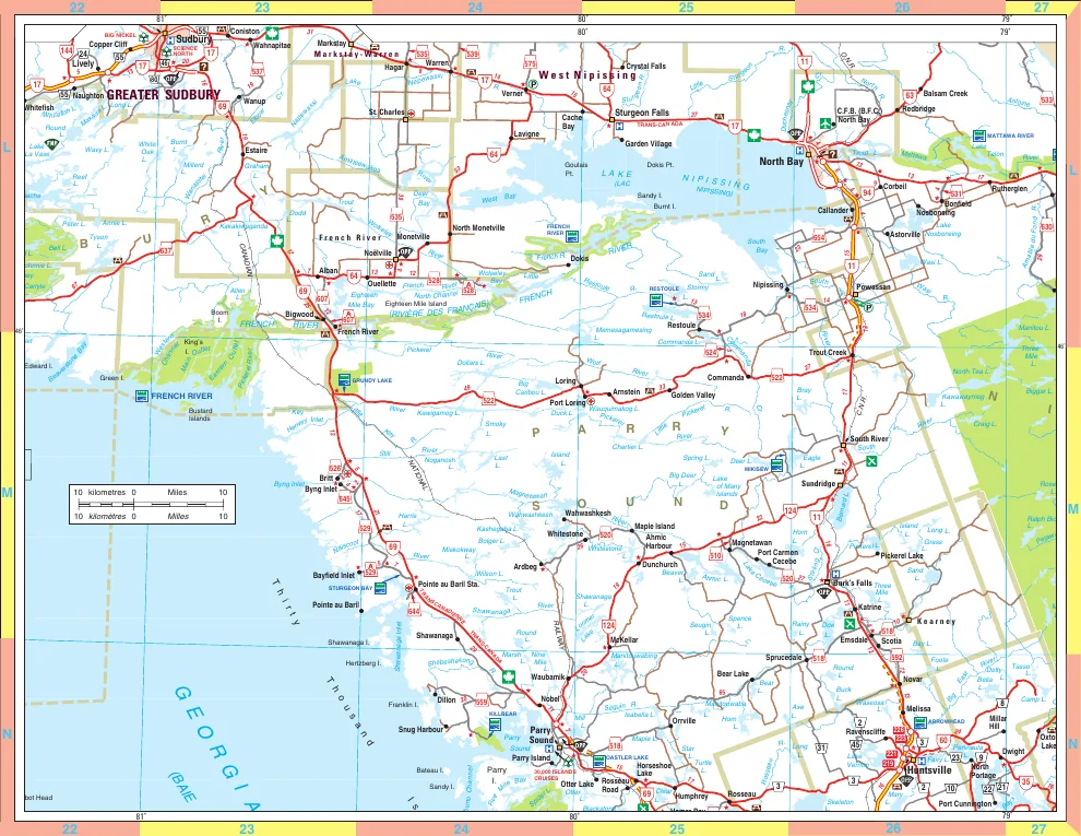
Also preserved from the old web root, this broader Parry Sound district map is useful for seeing the Seguin corridor in relation to Georgian Bay, Highway 69/400, Lake Joseph, Lake Rosseau, Emsdale and Kearney.
Depot Harbour fire-insurance plan, 1899
The original two-sheet Charles E. Goad plan is public domain and its archival identity is verified. Until the full-resolution scan is ingested into the local media store, the site now preserves a much more detailed two-sheet study and transcription so the historical information itself is not trapped behind an external link.
Guide Book & Atlas of Muskoka and Parry Sound Districts, 1879
The 149-page atlas predates the OA&PS and is therefore a valuable baseline for roads, property lots and settlement. Foley Township is confirmed on page 100 of the historical atlas. Rather than simply linking to the volume, the site explains how to compare the pre-railway township pattern with the later railway corridor.
Preservation rule
When rights permit, the preferred order is: keep the original locally; make a web-sized derivative; write a caption and explanation; record creator/date/source/rights; retain the external archive record only as provenance and deeper reading.