Falding
A small name on old maps and timetables that deserves to be put back into its geographic context.
Falding is a documented stop on the Ottawa, Arnprior & Parry Sound Railway. Historical station lists place it about 9.7 miles east of Depot Harbour in the working western sequence, between Otter Lake and Rankins. The Canadian Geographical Names Database also preserves a historic Falding Platform railway point at approximately 45.3000° N, 79.9000° W.
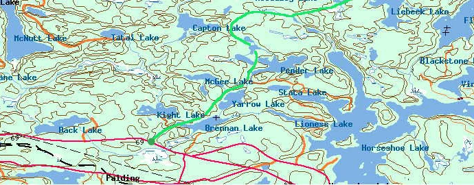
Falding on the OA&PS
The working station-distance sequence places Falding at roughly 9.7 miles east of Depot Harbour. The same western sequence continues through Maple Lake/Swords, Edgington, Seguin Falls, Bear Lake, Sprucedale, Mud Lake and Scotia Junction. That makes Falding part of the Booth railway story, not merely a nearby modern place name.
Foley Township history also records OA&PS stops at Falding and Rose Point before the line reached Depot Harbour. Later railway records preserve the names Falding and Falding Platform, and Library and Archives Canada catalogues plans for railway structures at Falding. Together, those records establish the railway association even though the precise platform/station footprint still deserves primary-source mapping.
Falding, Falding Platform and the crossing railways
The name is complicated by the later north-south railway. Federal geographic-name records preserve Falding Platform as a historic railway point at 45.3000° N, 79.9000° W, while a separate Falding locality lies nearby. A 1907 Board of Railway Commissioners record also documents a connection between the Canadian Northern and Grand Trunk railways at Falding. The interactive map now uses the documented historic railway-point coordinate while the exact Booth-era building footprint remains a separate research question.
Other small railway names nearby
More detailed station summaries list additional western-corridor names between Rose Point and Swords, including Otter Lake, Rankins and Beatty's. These now have their own research pages in the lost stops index.
A 1911 engineering-plan lead
Library and Archives Canada railway-plan finding aids index a 1911 plan for a Blackstone Road subway in Foley Township at Falding. That is unusually promising because an engineering drawing may show exact track/road geometry, structure dimensions and railway chainage — the kind of evidence that can turn an approximate historical point into a precisely understood site.
Future local archive item
The plan itself is now on the site's research register. If a reusable digital scan can be obtained, it will be stored locally with an explanatory transcription rather than merely linked from this page.
Open the railway-plan research register →
Do you have a photograph of Falding Platform?
We have useful maps and documentary material for this location, but additional historic or present-day photographs would make this page and its map hotspot much stronger. Contributions are moderated before publication.
Sources & research trail
- Historic OA&PS route/station summaries placing Falding at approximately mile 10.5 from Depot Harbour.
- Foley Township and Area History, which records OA&PS stops at Falding and Rose Point.
- Library and Archives Canada railway-plan catalogue entries for Falding structures/station material.
- Original SeguinTrail.ca western map, preserved locally.