The western railway corridor
A station-by-station guide from Georgian Bay to Scotia Junction, tying maps, settlements and railway history together.
The railway between Depot Harbour and Scotia Junction was a chain of ports, stations, platforms, sidings and junctions. The smaller railway names belong beside the better-known communities, while the terrain & operations page helps explain why many of those points existed where they did.
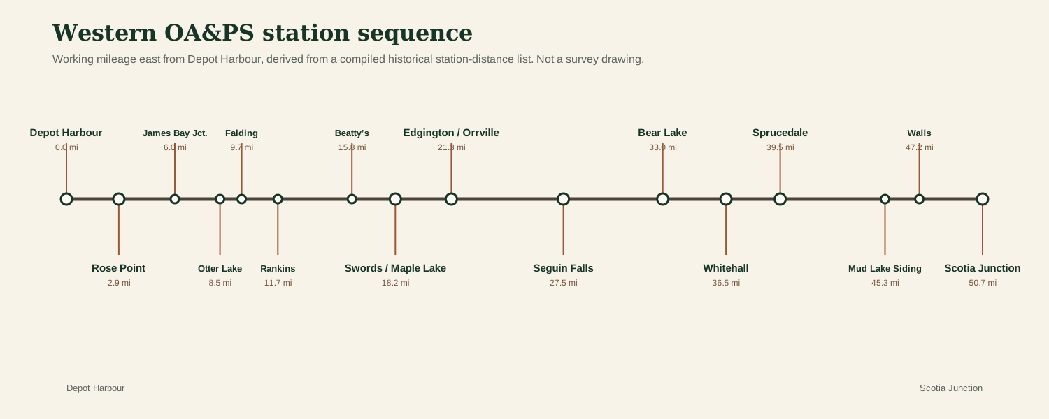
Station-by-station guide
Distances are shown eastward from Depot Harbour using a compiled historical station-distance sequence. They are useful for order and spacing; railway names and stopping arrangements changed over time, and exact building locations still need primary-source verification at several minor stops.
| Miles east of Depot Harbour | Place | Role | Location status |
|---|---|---|---|
| 0.0 | Depot Harbour | Major station / community | Documented corridor point |
| 2.9 | Rose Point | Major station / community | Documented corridor point |
| 6.0 | James Bay Jct. | Minor stop / railway point | Documented corridor point |
| 8.5 | Otter Lake | Minor stop / railway point | Documented corridor point |
| 9.7 | Falding | Minor stop / railway point | Documented corridor point |
| 11.7 | Rankins | Minor stop / railway point | Exact footprint not yet documented |
| 15.8 | Beatty’s | Minor stop / railway point | Exact footprint not yet documented |
| 18.2 | Swords / Maple Lake | Major station / community | Documented corridor point |
| 21.3 | Edgington / Orrville | Major station / community | Documented corridor point |
| 27.5 | Seguin Falls | Major station / community | Documented corridor point |
| 33.0 | Bear Lake | Major station / community | Documented corridor point |
| 36.5 | Whitehall | Major station / community | Documented corridor point |
| 39.5 | Sprucedale | Major station / community | Documented corridor point |
| 45.3 | Mud Lake Siding | Minor stop / railway point | Exact footprint not yet documented |
| 47.2 | Walls | Minor stop / railway point | Documented corridor point |
| 50.7 | Scotia Junction | Major station / community | Documented corridor point |
Construction came in stages
A predecessor-company synopsis records Scotia–Edgington opening July 1, 1893; Edgington–Rankins July 1, 1894; and Rankins–Rose Point July 1, 1895. That makes Rankins especially interesting: for roughly a year it marked the operating end of the westward railway.
Read the grade as railway engineering
A historical Grand Trunk profile records summits, rivers, lakes and elevations across the western corridor. The locally drawn terrain interpretation shows the climb from Georgian Bay toward Scotia and the named summit at Beatty siding.
Smaller names along the railway
The Lost Stops & Railway Names section brings together Beatty’s, Rankins, Otter Lake, Walls, Mud Lake and James Bay Junction, keeping these smaller points visible in the story of the line.